Is the Seefeld Plateau Good for Moderate-Altitude Hiking?
Is Seefeld a good base for moderate-altitude hiking near Innsbruck?
Seefeld sits at roughly 1,180m on a broad plateau north-west of Innsbruck, well below the high alpine terrain of the Nordkette or Patscherkofel, which makes it a gentler starting altitude for walking. It has hosted Nordic Olympic events twice, in 1964 and 1976, plus the 2019 Nordic World Ski Championships, which left it with an unusually developed base of lifts, paths and infrastructure for an outdoor plateau of its size.
A plateau built for the outdoors, not a high mountain
Twenty minutes north-west of Innsbruck, the road climbs out of the Inn valley and the landscape changes shape. Instead of a narrow valley floor pinned between two mountain walls, it opens into a broad, gently rolling plateau at around 1,180m: Seefeld. That single fact - the altitude, not any one summit or trail - is the honest starting point for answering whether this is a good base for moderate-altitude hiking.
It is roughly 600m above Innsbruck’s own centre at about 574m, high enough to feel like a change of air, but nowhere near the high alpine terrain that begins on the Nordkette above the city or on Patscherkofel to the south, both of which climb well past 2,200m from valley stations far lower than Seefeld already sits.
That difference in profile is the whole appeal. Where Innsbruck’s mountains are steep and vertical - you ride a cable car up and then choose how far to go on foot from an already dramatic height - Seefeld starts you on a plateau. The walking here is shaped by relatively open, undulating ground rather than by a single big ascent, which is a genuinely different kind of day out from a Nordkette or Patscherkofel hike.
An Olympic plateau, twice over
Seefeld’s outdoor infrastructure did not appear by accident. The plateau hosted the Nordic skiing events - cross-country and ski jumping - for the Winter Olympics on two separate occasions, in 1964 and in 1976, both times as the Nordic venue for a Games centred on Innsbruck. It returned to the world stage again in 2019, hosting the Nordic World Ski Championships. That is three major events across more than fifty years, and it is worth being precise about it: Seefeld is not a one-time Olympic footnote, it hosted the Games twice, plus a World Championships since.
The practical legacy of that history, for a hiking-focused visitor, is less about any specific trail and more about what an internationally aged winter-sports plateau tends to have: a dense network of paths, signposted routes, lifts, and a town built around moving people through open countryside on foot, on skis or on a bike. In summer, that same infrastructure - much of it built or upgraded for Nordic competition - becomes the backbone of the walking season. For the Games history itself, including how the venues were used and what remains of them, see the dedicated Seefeld Olympic and Nordic heritage guide.
What “moderate-altitude hiking” actually means here
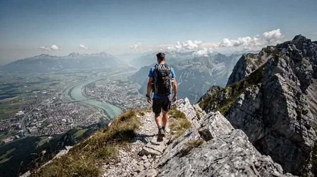
It is worth being direct about what this page can and cannot promise. Seefeld’s summer trail network is real and well used, but this site does not maintain a verified list of specific trail names, distances or walking times for the plateau’s hiking routes, and none should be assumed from what follows. What can be said reliably is the character of the terrain: a plateau setting, at a moderate altitude by Alpine standards, with a mix of open meadow, forest edge and lake-adjacent ground, framed by higher mountains rather than climbing among them.
That framing matters for planning. A day on the Seefeld plateau reads differently from a day on the Nordkette or on Patscherkofel: less vertical gain, less exposure, and a landscape that stays walkable in more variable weather because you are not committed to a single lift-served ridge line. For visitors weighing up which side of Innsbruck’s mountain geography suits them, the practical guide to hiking trails on the Nordkette makes a useful contrast: that massif starts high and stays high, while Seefeld starts moderate and stays moderate.
The Karwendel range forms much of the dramatic skyline visible from the plateau, and it is a genuinely different hiking proposition - higher, more rugged, and covered on its own terms in the Karwendel hiking guide rather than here. Seefeld’s plateau and the Karwendel’s high limestone peaks share a view, not a walking style.
Seefeld versus Innsbruck’s own mountains
| Seefeld plateau | Nordkette | Patscherkofel | |
|---|---|---|---|
| Base altitude | ~1,180m | ~574m (city) to ~2,334m summit | ~574m (city) to ~2,246m summit |
| Terrain character | Rolling plateau, meadows, forest, lakes | Steep high-alpine ridge and rock | Rounded high-alpine summit |
| Access from Innsbruck | Train or regional bus, ~20-30 minutes | Funicular and two cable car stages | Cable car from Igls |
| Typical use | Walking, Nordic sport legacy, e-biking | Serious alpine hiking, via ferrata, freeride | Hiking, family-friendly summit views |
The comparison is not about one being better than the other - it is about matching the terrain to what a visitor wants from a day outdoors. Someone chasing the fastest possible climb from a European city centre to genuine high-mountain terrain should look at the Nordkette cable car; someone who wants a gentler, more open plateau with lakes and rolling ground, and who is happy to travel half an hour out of the city for it, is better served by Seefeld.
Getting there from Innsbruck
Seefeld sits on a regional rail line that continues toward the German border, and it is served by regular trains and buses on the VVT public transport network that also covers Hall in Tirol and the valleys further out. There is no special transfer required - it is a normal regional journey from Innsbruck, which keeps the plateau realistic as a day trip rather than requiring an overnight stay.
For a fuller picture of how the wider Seefeld area connects by public transport, including routes toward Zirl and Telfs at the edge of the plateau, see the guide to reaching Seefeld, Stubai and the Ötztal by public transport.
Drivers reach the plateau via the road that climbs out of the Inn valley near Zirl, through the Martinswand cliffs, before the ground opens out toward Seefeld and neighbouring Leutasch - a useful reminder that this plateau extends beyond the town itself into a wider basin of villages.
When to go, honestly
Tyrol’s shoulder seasons apply here as much as anywhere else in the region. Mid-April to the end of May, and again in November, are the quiet, cheap, and unpredictable months: some lifts, huts and facilities reduce hours or close for maintenance, and higher ground can still carry snow patches well into late spring.
The core summer hiking window is roughly June through September, once the snowline has retreated from the higher parts of the plateau and surrounding slopes - though exactly when that happens varies from year to year depending on the winter before it. Anyone planning a Seefeld-based hiking trip should check current lift and trail conditions before travelling rather than assume a full programme is running; the general season guide for hiking in Tyrol sets out that reasoning in more depth.
Because the plateau sits at a real if moderate altitude, weather can still shift faster than it does down in the Inn valley. The Föhn, a warm dry wind that can sweep in from the south and change conditions within hours, affects the whole region including Seefeld, and it is worth building a little flexibility into any hiking plan rather than fixing a single route days in advance.
Beyond walking: what else the plateau offers
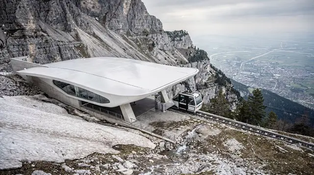
Seefeld’s Olympic-grade infrastructure did not stay locked to winter sport, and several of the ways to explore the plateau in the warmer months use exactly the lifts and paths built up over decades of Nordic events. The Rosshütte funicular carries visitors up from the town toward higher ground with views back across the plateau and out to the Karwendel skyline - a good option for anyone who wants elevation and a view without a long walk to earn it:
a roundtrip funicular ride up to the Rosshütte above Seefeld, or, for those who want to keep climbing from there, the connecting Gipfelpass ascent from the Rosshütte toward the Härmelekopf.
For walkers who prefer a guided introduction to the plateau’s own lower terrain rather than the lift-served high points, guided routes cover the plateau’s characteristic mix of open ground and water:
a guided walk taking in two of the plateau’s lakes and the Brunschkopf or a route over the Gschwandtkopf, both structured as day outings rather than long alpine tours.
Seefeld’s flat-to-rolling ground also suits cycling more comfortably than the steep valleys around Innsbruck do, and an e-bike is a practical way to cover more of the plateau’s lakes and moorland in a day than walking alone allows: a guided e-bike tour among the plateau’s lakes and moors is built around exactly that terrain.
None of these options require technical hiking experience, which is consistent with the plateau’s overall character: this is a place to move through open, moderate-altitude countryside at a comfortable pace, not to tackle a demanding alpine summit.
Who Seefeld’s plateau actually suits
Putting the pieces together, Seefeld works well as a hiking base for visitors who want gentler, more open terrain than Innsbruck’s own high mountains offer, who are comfortable travelling half an hour out of the city, and who are realistic about the fact that its reputation rests on Nordic sporting history rather than on a marquee summer trail.
It suits families, visitors recovering from a harder day on the Nordkette or Patscherkofel, and anyone curious about a plateau shaped by two Olympic Games and a World Championships rather than by a single dramatic peak. It is a poor fit for hikers specifically chasing high alpine exposure or via ferrata - that terrain belongs to the Karwendel and to Innsbruck’s own mountains, not to this plateau.
For planning a broader stay that mixes the plateau with wellness facilities and other nearby villages such as Leutasch, see the Seefeld nordic and wellness itinerary, and for a wider sense of what else the area offers beyond hiking, the Seefeld activities overview and the general hiking and mountains category both round out the picture. For overnight options on the plateau itself, the guide to mountain huts around Innsbruck also covers ground relevant to longer stays based out of Seefeld.
Seefeld plateau hiking: frequently asked questions
How many times has Seefeld hosted the Winter Olympics?
Twice. Seefeld staged the Nordic skiing events - cross-country and ski jumping - for the 1964 and the 1976 Winter Olympics, both held in Innsbruck. It also hosted the 2019 Nordic World Ski Championships, which is a separate, more recent event and not a third Olympics.
How high up is the Seefeld plateau?
About 1,180m above sea level. That is roughly 600m higher than Innsbruck’s city centre at about 574m, but well short of high alpine terrain - the Nordkette above Innsbruck rises to 2,334m and the Karwendel peaks visible from Seefeld go higher still.
Is Seefeld too high for a first-time visitor to walk comfortably?
No. At around 1,180m, altitude is not a meaningful physical concern for most walkers - it is comparable to many mid-elevation European towns. The plateau’s relatively flat, open character, rather than its altitude, is what makes it feel accessible after the steep valley walls around Innsbruck.
Does Seefeld’s Olympic history mean there are marked trails from the Games era?
The Olympic legacy is mainly in infrastructure and reputation - stadium sites, cross-country facilities and a plateau shaped for outdoor sport - rather than in specific named summer hiking routes tied to 1964 or 1976. Trail choice and route planning should be checked locally rather than assumed from the Olympic connection.
Is Seefeld part of the Karwendel range?
No. Seefeld sits on its own plateau to the south-west of the Karwendel massif, which rises as a backdrop rather than forming the ground the town sits on. The Karwendel is treated as a separate destination and hiking area in its own right.
How do you get from Innsbruck to Seefeld without a car?
By train or regional bus on the VVT network; Seefeld is a well-connected stop on the line toward Germany, and the journey from Innsbruck is a regular regional service rather than a special transfer.
When is the best time to hike on the Seefeld plateau?
Roughly June to September, once snow has cleared from higher ground, is the core season for plateau walking in Tyrol generally. Spring (mid-April to end of May) and November are the quiet shoulder months when some lifts and facilities reduce hours or close for maintenance, so it is worth checking operating dates before travelling.
Is Seefeld only a winter destination?
No. Seefeld is best known internationally for Nordic skiing and its Olympic and World Championship history, but the same plateau setting - open, relatively gentle, well served by lifts and paths - carries over into a distinct summer hiking season.
Mountain hiking on GetYourGuide
Verified deep-linked GetYourGuide tours. Book through these links and we earn a small commission at no cost to you.
GetYourGuide does not provide a product photo for this activity — the image shows the meeting point, photographed by us.