Patscherkofel Hiking Guide: The Quiet Mirror of the Nordkette
Is the Patscherkofel a good hiking alternative to the Nordkette?
Yes, for a quieter day. The Patscherkofel rises to 2,246 m on the south side of the Inn valley, almost mirroring the Nordkette's 2,334 m to the north, and its trails are noticeably less crowded. It looks back at Innsbruck rather than down into it, and its lift is not a year-round service, so check operating dates before you plan the day around it.
Innsbruck is unusual for having two named summits standing guard over it, one on each side of the Inn valley. Everybody knows the Nordkette, the wall of rock that rises straight out of the old town to 2,334 m. Far fewer visitors make the trip to its quieter counterpart on the south side: the Patscherkofel, at 2,246 m, looking back across the rooftops at the mountain everyone else went up.
That near-symmetry — barely 90 metres in it — is the whole premise of this guide. If you already did the Nordkette, or you are trying to decide which of the two deserves your one clear-weather day, the Patscherkofel is worth taking seriously as an alternative rather than a footnote.
A mountain in the shadow of a more famous one
The Patscherkofel sits above Igls, the small resort village on the southern flank of the Wipptal side of the valley, a short ride from central Innsbruck. It was one of the venues for the city’s Winter Olympics, and it has a long history as a local ski and hiking mountain rather than a headline attraction — which is exactly its appeal.
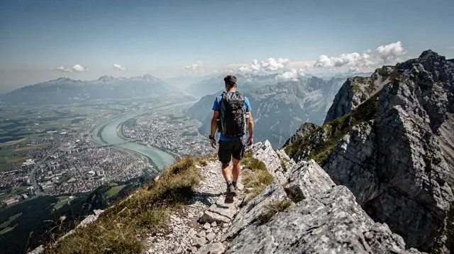
Where the Nordkette drops almost vertically into the city, making the descent feel like leaving a metropolis for high alpine terrain in one motion, the Patscherkofel is a rounder, more approachable massif. The lift-served zone opens onto gentler summit terrain and a genuinely different photograph: instead of looking down at Innsbruck’s rooftops from directly above, you look across the valley floor at the Nordkette’s serrated ridge, with the city spread out in the gap between the two mountains. Locals will tell you this reverse view is, in its own way, more satisfying than the more famous one — you get the postcard shot of the Nordkette that you cannot get while standing on it.
Patscherkofel and Nordkette, side by side
Both peaks are reachable from the city centre by lift, both offer summit hiking, and both are usually discussed as day trips rather than full mountain expeditions. Here is how they compare on the points that matter for planning.
| Patscherkofel | Nordkette | |
|---|---|---|
| Summit altitude | 2,246 m | 2,334 m (Hafelekarspitze) |
| Side of the Inn valley | South | North |
| View | Looks back across the valley at the Nordkette and the city between | Looks straight down onto the old town and the Inn |
| Crowds | Noticeably quieter | Innsbruck’s single busiest viewpoint |
| Character | Rounder terrain, gentler approach to the summit area | Sheer, dramatic, exposed rock scenery close to the lift |
| Access | Lift from the Igls side of the valley | Three linked lifts (Hungerburgbahn, Seegrubenbahn, Hafelekarbahn) from the city |
| Season closures | Typically closed mid-April to end of May and in November for maintenance | Same shoulder-season pattern applies across most Tyrolean lifts |
Neither figure in that table is a coincidence of memory — Innsbruck genuinely sits pinned between two mountains that differ in height by less than 100 metres, which is part of why the city’s setting reads as so dramatic even though it is, at 574 m, not itself especially high.
If your priority is the single most famous Innsbruck view and you don’t mind sharing the platform with a busy crowd, the Nordkette hiking trails are still the headline act — see the full Nordkette cable car guide for that side of the comparison. If you’d rather trade a little fame for a lot more quiet, and you want the view of the Nordkette rather than from it, the Patscherkofel is the better call. We’ve laid the decision out in more detail in Nordkette or Patscherkofel: which mountain.
Getting up the mountain
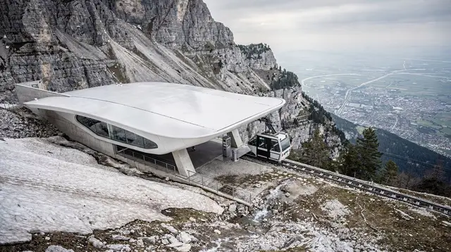
The Patscherkofel is reached by cable car from the base station on the Igls side of the valley, a short journey from Innsbruck by public transport. We are deliberately not printing a specific journey time, a specific lift price or a specific named trail here: Tyrolean lift operators adjust timetables, ticket pricing and trail markings from one season to the next, and the honest approach is to point you to the source that is actually current rather than freeze a number that may already be wrong by the time you read it. Check the lift operator’s own site or the Innsbruck tourism information office for today’s schedule and fares before you set off.
What we can tell you with confidence is the one detail that trips visitors up every year: the lift does not run every day of the year. Like most cable cars in this part of the Tyrol, it closes for maintenance during the shoulder seasons — broadly mid-April to the end of May, and again in November — when snow cover is unreliable on the upper mountain and operators use the quiet weeks for servicing. If you are planning a trip in either window, confirm operating dates before you build a day around reaching the summit, and have a lower-altitude backup in mind. The same caution applies across the region — see our general note on when to hike in Tyrol by season.
What the hike actually offers
Once you’re up, the appeal of the Patscherkofel is less about ticking off a dramatic via ferrata and more about spending unhurried time on an easy-access alpine summit with space to breathe. The lift-served area opens onto rolling high terrain rather than the sheer drops that define the Nordkette’s Hafelekar side, which makes it a comfortable choice for hikers who want mountain scenery without exposure.
Because we don’t verify specific trail names, marked route numbers or walking times for this summit, treat any route description you read elsewhere — including ours — as a starting point, not a substitute for the current trail map posted at the lift station. Tyrolean hiking signage is generally excellent and colour-coded by difficulty, and mountain huts in the area post their own opening information, which is worth checking directly rather than relying on secondhand details. For general orientation on hut culture in the region, our guide to the best mountain huts around Innsbruck is a useful companion, even though it does not pin specific huts to this particular summit.
The reward, in any case, is consistent across seasons: open views south into the Wipptal and, most memorably, straight back across the valley at the Nordkette’s ridge with Innsbruck laid out beneath it. On a clear day this is arguably the single best angle from which to appreciate how tightly the city is wedged between its two mountains — a fact that photographs better from here than from almost anywhere else in the valley.
When to visit
Summer through early autumn is the reliable window for hiking the upper mountain, once winter snow has cleared from the higher paths — usually from late June or July depending on how the previous winter went, in line with the pattern across the wider Tyrol region. Midwinter turns the same terrain into ski and snowshoe country instead, and the shoulder-season closures already mentioned mean the lift itself may simply not be running in the gaps between the two.
Weather on the Patscherkofel behaves like weather everywhere in this part of the Alps: changeable, and worth checking the morning of, not the night before. The Föhn wind that periodically sweeps down from the south can clear the sky dramatically in a matter of hours, which is good news for photography but can also mean sudden temperature swings — pack layers even on a day that starts warm in the city.
Planning a Patscherkofel day from Innsbruck
A visit here fits naturally into a single half-day or full day, and it pairs well with the Igls village itself if you want a slower pace, or with a broader look at the city’s southern side. Because the mountain isn’t the singular headline attraction that the Nordkette is, it also suits travellers who already spent a day up the Nordkette and want a second, less crowded alpine outing without repeating the same view.
Bring the same basics you’d pack for any Tyrolean high-altitude outing: sturdy footwear, a layer against wind at altitude even in summer, sun protection (UV is stronger at 2,000-plus metres than it feels), and cash as a backup, since some smaller mountain facilities in the region still prefer it. If you’re combining the trip with wider exploring, our how many days in Innsbruck guide and the Alpine Hiking Week itinerary both give a sense of how a Patscherkofel day slots into a longer stay.
Guided options if you’d rather not plan the route yourself
If the absence of a fixed trail name or timing in this guide makes you want a guide rather than a map, there are structured ways to experience the mountains around Innsbruck with someone who knows the current routes and conditions. A circular hiking route on the Patscherkofel itself is the most direct match for this guide, following a loop on the mountain with a local leader rather than a self-navigated trail. For something more tailored, a private guided hike in the mountains around Innsbruck lets you set the pace and pick the day, which is useful if you want flexibility around weather or fitness level.
Hikers with a more specific interest — amateur radio operators, in particular — may want the summit hike with radio equipment in the Tyrolean mountains, a niche but genuinely popular activity on peaks around the region for Summits on the Air enthusiasts. And for a gentler introduction to mountain walking without committing to a full summit day, the panoramic hike across the Telfer Wiesen offers similar high-valley views from an easier starting point on the Nordkette side.
Patscherkofel hiking: frequently asked questions
Is the Patscherkofel a good hiking alternative to the Nordkette?
Yes, particularly if you want fewer crowds and a different perspective. At 2,246 m it comes close to matching the Nordkette’s 2,334 m, but the character of the two mountains differs: the Patscherkofel offers gentler terrain and a view back at the Nordkette itself, while the Nordkette gives the dramatic straight-down view of the city.
Is the Patscherkofel higher or lower than the Nordkette?
Lower, but by a narrow margin. The Patscherkofel’s summit sits at 2,246 m against the Nordkette’s Hafelekarspitze at 2,334 m, a gap of less than 90 metres — visually the two read as near-mirror images across the valley.
Does the Patscherkofel cable car run all year?
No. As with most Tyrolean lifts, it typically closes for maintenance during the shoulder seasons, roughly mid-April to the end of May and again in November. Confirm current dates with the lift operator before planning a visit in those windows.
Can you see Innsbruck from the top of the Patscherkofel?
Yes — this is the mountain’s signature view. From the south side of the valley you look back over the city and directly across at the Nordkette, a genuinely different angle from the one you get standing on the Nordkette itself.
Is the Patscherkofel suitable for beginners?
The lift-served summit area suits most reasonably fit hikers, but exact trail difficulty and route options change by season, so check the current trail map at the lift station rather than assuming a fixed difficulty level in advance.
How do I get to the Patscherkofel from Innsbruck?
The mountain rises above Igls on the south side of the Inn valley, a short public transport journey from the city centre. Confirm the current bus route and lift base station access locally, since schedules can change.
Is the Patscherkofel the same area as Igls?
No, though they’re closely linked. Igls is the village at the mountain’s base; the Patscherkofel is the peak and hiking terrain reached by cable car above it.
Should I do the Patscherkofel or the Nordkette if I only have time for one?
If you want the classic Innsbruck postcard view looking down over the rooftops, choose the Nordkette. If you’d rather have a quieter mountain, gentler terrain, and the reverse view looking across at the Nordkette from the south, the Patscherkofel is the stronger pick.
Mountain hiking on GetYourGuide
Verified deep-linked GetYourGuide tours. Book through these links and we earn a small commission at no cost to you.
GetYourGuide does not provide a product photo for this activity — the image shows the meeting point, photographed by us.