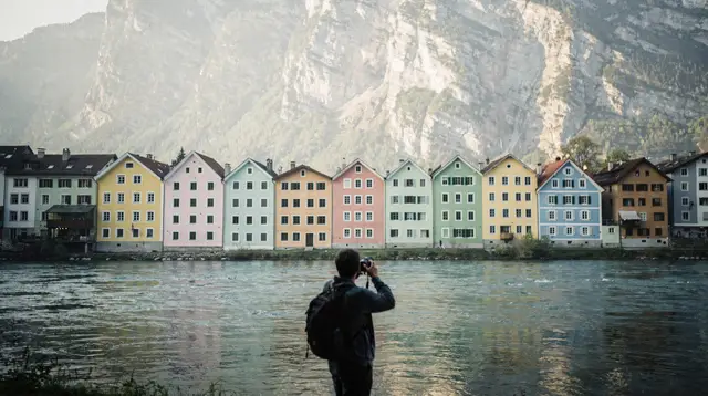
A mountain wall, not a single peak
Stand almost anywhere in Innsbruck’s old town and look north, and the ridge you see rising straight out of the Inn valley is the southern edge of the Karwendel. The Nordkette cable car, the one that gets visitors from 574 metres to over 2,200 metres in about twenty minutes, climbs the front face of this same range. What the Nordkette trip does not show you is how far the Karwendel extends beyond that first ridge: a long, folded band of limestone running west to east behind the city and behind the Seefeld plateau, with valleys, huts and trails that most day-trippers on the Hafelekar platform never see.
This page is about that wider range, not about the cable car itself or about Seefeld as a resort. If you came here looking for the fastest way up from the city centre, that story belongs on the Nordkette page. If you came here looking for Nordic skiing, Olympic history or Seefeld’s own town centre, that belongs on Seefeld’s page. What follows is about the Karwendel as a hiking and via ferrata destination reached from several different directions, with the honest caveat that some things about it — its exact size, its full protection status, its winter infrastructure — are not pinned down clearly enough in what we could verify to print as fact.
Getting there: several valleys, several doors
There is no single “entrance” to the Karwendel the way there is a single cable car base station for the Nordkette. Instead, a handful of valleys and towns act as doors into different parts of the range, and which one suits you depends on what kind of day you want.
The most straightforward option from the city is via Zirl, a short hop west along the Inn valley, where the Ehnbach gorge cuts up into the mountains at the foot of the Martinswand — the sheer rock face above the valley that gives this stretch of road its dramatic backdrop.
The gorge walk here is graded and largely level underfoot, which is why it works as a genuine family outing rather than a specialist hike; a guided family hike through the Ehnbach gorge is one of the few packaged ways to do this particular route with someone who knows the ground, rather than working it out from a trailhead map. For the fuller picture of the gorge itself, the dedicated Ehnbach gorge guide covers path conditions and timing in more depth than fits here.
A second door opens from Seefeld itself. The Rosshütte funicular, which exists primarily as Seefeld’s own mountain lift, also happens to lift walkers onto ground that connects into the southern Karwendel without the climb from the valley floor. A return ride on the Rosshütte funicular is worth considering purely as transport if your legs would rather start a hike at altitude than gain it on foot. We are deliberately not describing Seefeld’s own trail network or ski history here — that belongs to Seefeld’s page — but as an access point into the range, it is a real and useful one.
A third route runs through the Leutasch valley, west of Seefeld and close to the Bavarian border, where the Geisterklamm gorge offers another walkable cut into the mountains; the Leutasch gorge walk guide is the place to check current path conditions before you go. A fourth, quieter approach comes through Telfs, further along the Inn valley, useful mainly if you are already staying in that direction rather than as a first choice from the city.
If you would rather someone else handle the transport logistics entirely, a guided outing over the Gschwandtkopf pairs a lift-assisted start with a supervised route, which suits visitors who want a taste of this terrain without committing to route-finding on their own on a first visit.
| Access point | Approx. travel time from Innsbruck | How you get there | What it suits |
|---|---|---|---|
| Zirl / Ehnbach gorge | 20-25 minutes | Car or regional train | Families, gentle valley walking |
| Seefeld / Rosshütte | 30-40 minutes | Car or regional train + funicular | Lift-assisted starts, longer ridge days |
| Leutasch | 35-45 minutes | Car or regional bus | Quieter gorge walking, fewer crowds |
| Telfs | 25-35 minutes | Car or regional train | Visitors already based further along the Inn valley |
For the transport details behind these numbers — timetables, tickets and whether a car actually saves time — the public transport guide for Innsbruck and the valleys and the driving guide covering the vignette, tolls and winter tyre rules are worth reading before you commit to a plan, especially outside the summer months when some routes change.
What you can genuinely do here in summer
The Karwendel’s honest selling point is scale rather than a single headline attraction. Where the Nordkette or the Patscherkofel give you one lift and one obvious viewpoint, the Karwendel gives you long valleys, ridgelines and hut-to-hut possibilities that reward people who like to actually walk rather than photograph a summit and head back down.
Hiking is the core activity, and it ranges from the near-flat gorge paths at Zirl and Leutasch to full-day ridge routes with real elevation gain. Trail marking in the Austrian Alps is generally reliable, but the Karwendel’s paths are less heavily trafficked and less thoroughly signposted at every junction than routes closer to the old town’s immediate surroundings, so a printed or downloaded map matters more here than it does on the Nordkette’s well-worn paths.
The Karwendel hiking guide sets out specific routes and difficulty levels in more detail than a destination overview can responsibly cover, and the seasonal hiking guide for Tyrol explains how snow cover at altitude shifts the safe hiking window from year to year.
Via ferrata routes run through several sectors of the range for those equipped and experienced enough to use them. These are not casual walks: a harness, a via ferrata lanyard set and a helmet are the minimum kit, and route grading varies from introductory to genuinely serious.
The Karwendel via ferrata guide lists specific routes, and the gear and safety basics guide is worth reading even if you have done via ferrata elsewhere, since conditions and rock quality differ range to range. If you are weighing up whether via ferrata belongs on this trip at all, the broader things to do: hiking and mountains category page lists it alongside the Karwendel’s gentler alternatives so you can compare before booking anything.
Mountain huts scattered through the range provide food, water and, in many cases, overnight beds, which is what makes multi-day traverses realistic here in a way they are not on the smaller mountains right at the city’s edge. The guide to the best mountain huts around Innsbruck covers which huts are reachable in a day from which valley, and what to expect from them — cash-only payment and simple, hearty food being the norm rather than the exception.
What this page will not tell you
In keeping with the rest of this site’s approach, it is worth being direct about the gaps. We do not print an exact figure for the Karwendel’s total area or a precise description of its protected-area status, because the sources available to us disagreed or were unclear, and a wrong number printed confidently is worse than an honest gap. If you need that figure for planning or writing purposes, the relevant Tyrolean nature park authority or an up-to-date hiking map publisher is a better source than any single travel page.
The same caution applies to winter activity in the range. Ski touring and off-piste skiing happen in parts of the Karwendel, but we do not have reliable, current detail on which sectors are realistically accessible, how routes are marked, or what avalanche infrastructure exists in a given season. That is different from the Olympia SkiWorld network around the city, which is a mapped, lift-served ski area with published information. Treat a Karwendel winter trip as something to plan with a local mountain guide or ski school, not as a self-guided outing based on a travel page — including this one.
Where to base yourself
Most visitors do not stay inside the Karwendel itself; they base themselves in Innsbruck, Seefeld, Zirl or Telfs and treat the range as a day trip or an overnight hut detour from there. Staying in the city keeps you close to everything else this site covers — the old town, the Nordkette, day trips further afield — at the cost of a slightly longer approach to the quieter Karwendel valleys. Staying in Seefeld or Zirl instead shortens that approach but puts you further from the city’s restaurants, museums and transport hub. Neither choice is wrong; it depends on whether the Karwendel is the main event of your trip or one day among several.
If you are new to the city and want an easy, guided introduction before tackling anything more remote, a guided welcome tour of Innsbruck is a reasonable way to get oriented on day one, leaving the Karwendel for a clearer-headed day two or three once you know your way around the transport network described above.
Practicalities
Weather changes quickly at altitude here, exactly as it does on the Nordkette and Patscherkofel closer to the city: a warm morning in the valley does not guarantee warm conditions on an exposed ridge, and the Föhn wind that affects Innsbruck’s weather can behave differently just a few kilometres north. Carry layers, water and a paper map or offline map download rather than relying on mobile signal, which is inconsistent in the deeper valleys and on north-facing slopes.
Huts generally accept cash more reliably than cards, so carry some even if you have gone cashless everywhere else in Tyrol. Trailhead parking at Zirl, Leutasch and the Seefeld side fills up on clear summer weekends, so an early start helps more here than a later one would on better-served routes closer to the city.
Karwendel hiking FAQ: access, season and safety
How do you get to the Karwendel from Innsbruck without a car?
Regional buses and trains from Innsbruck reach the valleys that border the range, including Zirl, Telfs and the Seefeld plateau, in well under an hour. Once you arrive, onward movement inside the range itself is mostly on foot, so plan your route before you set off rather than assuming a bus will meet you partway up.
Is the Karwendel the same place as Seefeld?
No. Seefeld is a plateau town with its own ski and Nordic sports history, and it has its own dedicated page on this site. The Karwendel is the much larger mountain range that begins behind and above Seefeld, reached from several different valleys, of which Seefeld is only one gateway.
How large is the Karwendel, and is it a protected nature area?
It is widely described as one of the larger limestone ranges in the Northern Alps, and parts of it carry some form of nature protection. We are not stating an exact area or a specific protection category here because the figures we could confirm were inconsistent, so check current signage or the relevant Tyrolean nature park authority before quoting a number yourself.
Can you ski-tour in the Karwendel in winter?
Ski touring and off-piste lines do exist in parts of the range, but we do not have confirmed, current details on marked routes, avalanche infrastructure or which sectors are realistically accessible in a given winter. Treat any winter plan here as a job for a local mountain guide or ski school, not a self-guided outing based on this page.
Do you need via ferrata experience, or can beginners hike here too?
Both exist side by side. Valley-floor and lower-slope trails are straightforward walking, while the fixed-rope via ferrata routes need a harness, a via ferrata set, and at least some prior experience or a guide. Pick the one that matches your fitness and gear, not the other way around.
Is one day enough, or is it worth staying overnight?
A single day from Innsbruck, Zirl or Seefeld is enough to walk one valley or ridge section and get back down before dark. Staying one night in a mountain hut opens up a longer traverse the next morning and removes the pressure of a fixed return time, which matters more here than on shorter, better-signposted routes closer to the city.