Hiking in the Karwendel from Innsbruck: What to Expect
Can you hike the Karwendel on a day trip from Innsbruck?
Yes, in season. The Karwendel sits in the Seefeld-Karwendel region northwest of Innsbruck, and its higher trails are usually walkable only from late June or July, once snow clears from altitude. Specific routes and timings are best confirmed with local tourism offices or official hiking maps rather than planned around a single named trail in advance.
Does a Karwendel Hike Actually Fit into a Day from Innsbruck?
The honest answer is: it depends on the month, and on which part of the range you mean. The Karwendel is not a single trail or a single peak — it’s a large limestone massif that rises north of the Seefeld plateau, and “hiking the Karwendel” can mean anything from an easy valley-floor path near a village to a full alpine route that only makes sense for an experienced, well-equipped hiker with a full day and settled weather.
This guide won’t pretend there is one definitive Karwendel day hike with a name, a distance and a time attached to it, because that isn’t something this site can verify and get right for every reader in every season. What it will do is set out where the range actually sits relative to Innsbruck, what the season really allows, how you get there, and where to go for the specific, current trail information that changes from year to year.
If you’re arriving with the assumption that any Alpine destination is walkable whenever you happen to be visiting, the Karwendel is a useful place to have that assumption corrected early.
Where the Karwendel Sits, in Real Terms
The Karwendel forms the northern edge of the mountains around Innsbruck, and the part of it most accessible from the city falls within what local tourism bodies group together as the Seefeld-Karwendel region — the plateau town of Seefeld and the high ground immediately north and east of it. That puts the range roughly northwest of Innsbruck, on the opposite side of the Inn valley from the Nordkette, and reachable via the same road and rail corridor that serves Seefeld, Zirl and Leutasch.
It helps to be precise about what’s nearby and what isn’t. Seefeld itself, covered as its own destination on this site, is the plateau town and the usual base — but a stay in Seefeld doesn’t automatically mean a Karwendel summit hike is on the table that day; it depends on season, conditions and which specific access point you’re working from. The gorges at Zirl and Leutasch sit at the foot of the range and offer a different, lower-altitude kind of walking — a useful distinction to keep in mind, because a gorge walk and a Karwendel ridge route are not interchangeable days out even though both fall under the same regional name.
The Season Question That Comes Before Everything Else
This is the single most important thing to get right before planning a Karwendel day: high Alpine terrain in this part of Tyrol is not generally walkable year-round. Snow lingers on higher trails well into spring in most years, and the honest, site-wide rule for this region is that upper routes are usually not reliably clear until late June or into July, depending on how much snow the preceding winter left behind. Some years that window opens earlier; after a heavy winter, or in a cool spring, it can open later. There is no fixed calendar date that applies every year, which is exactly why this guide, and this site’s broader season guide for hiking in Tyrol, avoid naming one.
A rough seasonal picture looks like this:
| Period | What to expect at altitude |
|---|---|
| November to April | Winter conditions at altitude; not a hiking season for high routes |
| May to mid/late June | Transitional — lower paths may be walkable, higher trails often still snow-affected |
| Late June/July to September | The main window for high Karwendel routes, conditions permitting |
| October | Shortening days and an earlier return to autumn/winter conditions at altitude |
Treat that table as a general shape, not a promise. The only way to know whether a specific route is open on a specific date is to check with the people who maintain it.
One quirk worth knowing before you fix a date: this part of Tyrol gets frequent föhn conditions, a warm, dry wind that can strip cloud from the mountains and deliver a strikingly clear, mild day in the middle of an otherwise ordinary week — sometimes accompanied by headaches for people sensitive to it. A föhn spell can make the Karwendel look temptingly close and clear from the Inn valley even outside the main hiking window, but a clear sky at valley level doesn’t override the snow-cover and trail-condition realities described above. Treat good visibility as a bonus for planning a scenic drive or a lower walk, not as confirmation that a high route has opened early.
Who Actually Confirms the Details
Because this site can’t verify a named trail, its exact distance, or its current condition for every visit, the right move for anyone planning a Karwendel hike is to go straight to the source: the tourism offices covering Seefeld and the wider Seefeld-Karwendel region, and official Tyrolean hiking map providers. These are updated for the current season, they flag closures after storm damage or rockfall, and they rate difficulty in a way a travel guide simply can’t replicate responsibly. If you take one piece of advice from this page, make it that one — confirm route, distance and difficulty locally before you commit a full day to it.
This site’s guide to Tyrol’s mountain huts is a reasonable starting point for the kind of infrastructure — refuges, waymarking, refreshment stops — that Karwendel routes may or may not include, but again: hut opening dates shift year to year and need the same local confirmation.
What the Range Generally Offers
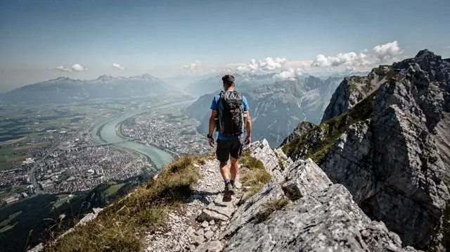
In broad terms, the Karwendel is characterised by the same limestone scenery that defines much of the Northern Limestone Alps: pale rock faces, high plateaus, and a more rugged, less groomed feel than the gentler grass mountains south of Innsbruck like the Patscherkofel.
That’s a general description of the terrain type, not a route recommendation — the actual paths, their exposure and their technical difficulty vary enormously across a range this size, from gentle plateau walks to routes that shade into scrambling and, on dedicated lines, into via ferrata territory covered separately on this site (see the dedicated Karwendel via ferrata guide rather than this page — via ferrata calls for a harness, a lanyard set and different skills to ordinary hiking, and shouldn’t be assumed as part of a normal walking day).
Broader hiking and mountains activities across the Innsbruck region are catalogued on this site if the Karwendel’s season or difficulty doesn’t line up with your dates — the mountains south of the city, reached via the Nordkette or Patscherkofel lifts, often have a longer practical season for casual walkers precisely because they’re lower and closer to town.
Getting There from Innsbruck
However you approach the Karwendel, you’re travelling out of the Inn valley toward the Seefeld-Karwendel region, generally by the road and rail line that also serves Zirl and Seefeld. That’s a genuine day-trip distance from Innsbruck in terms of transport time, but transport time and hiking time are two different budgets — get to a trailhead early enough, and confirm you can also get back, especially if you’re relying on the last bus or train of the day rather than a car. If your plan involves a specific lift or shuttle, check its last-departure time before you set off up the mountain, not on the way down.
For travellers who’d rather not build a full logistics plan around an unconfirmed trail, a few structured options cover this general area with guiding, transport and timing already handled.
a guided walk past two lakes and up toward the Brunschkopf, in the Seefeld area gives a taste of the plateau’s easier, lower terrain without requiring you to piece together trail information yourself. For something less strenuous, a return funicular ride up to the Rosshütte above Seefeld puts you at altitude with mountain views and none of the route-finding.
Getting There Without a Car
You don’t need your own transport to reach the Seefeld-Karwendel region from Innsbruck. The same rail line that serves Seefeld runs regularly from Innsbruck’s main station, stopping at Zirl on the way, and it’s the option most day-trippers without a hire car end up using. Regional trains on this line run frequently enough during the day that you’re not locked into a single departure, though the last services back to Innsbruck do have a cut-off, and it’s earlier than many visitors expect — check it before you leave the valley floor, not once you’re back down from altitude and tired.
Buses cover some of the same ground and reach a few points the railway doesn’t, including parts of Leutasch, but timetables thin out considerably outside peak summer months. If your day includes a lift, a guided walk or an e-bike return, as with the options further down this page, confirm the pickup and return point matches where the train or bus actually drops you — logistics mismatches, not the hiking itself, are what tend to unravel a car-free Karwendel day.
Driving is straightforward if you have a car, on the same road corridor, but parking at the more popular trailheads fills early on clear summer weekends. Arriving by rail sidesteps that problem entirely, at the cost of being tied to a timetable rather than your own schedule.
Easier Days Around the Same Region
Not every visit to this part of Tyrol needs to be a committed hiking day. If the season is wrong, the weather doesn’t cooperate, or you’re travelling with people who don’t want a long walk, the Seefeld-Karwendel area still has ways to get up and into the scenery.
a guided outing over the Gschwandtkopf near Seefeld is a gentler alternative for a shorter day, and an e-bike route around the Arnspitze covers ground on two wheels rather than on foot, which suits travellers short on hiking time but not on curiosity about the area. None of these substitute for a proper Karwendel summit route if that’s what you’re after, but they’re honest, bookable ways to spend time in the same landscape without betting a whole day on trail conditions you can’t check from home.
If your interest in this corner of Tyrol runs toward gorges rather than ridgelines, a family-friendly walk through the Ehnbach gorge near Zirl is a lower-altitude, lower-commitment option at the foot of the same general area, and pairs naturally with the Zirl gorge guide already on this site.
What a Half-Day Near Seefeld Actually Looks Like
Not everyone wants to commit a full day to an unconfirmed high route, and a half-day around Seefeld is a reasonable way to see the area without that commitment. A typical shape: a late-morning train or drive out from Innsbruck, a lift or guided outing such as the Rosshütte funicular or the Gschwandtkopf walk mentioned above, an hour or two at altitude taking in the views back toward the Karwendel’s higher ground, and a return to Innsbruck in time for an ordinary evening in the city.
That’s a deliberately modest itinerary, and it won’t get you onto the massif’s higher ridgelines — nothing short of a full, properly planned day will. What it does offer is a low-risk way to judge the weather, the crowds and your own appetite for a longer Karwendel day before booking one, and it works in shoulder-season weeks when the higher trails mentioned earlier in this guide are still snow-affected but the lower plateau around Seefeld is already pleasant walking weather.
Building a Longer Trip Around It
A single Karwendel day rarely stands alone on an itinerary — most visitors pair it with other mountain days around Innsbruck, or fold it into a broader week of Alpine walking. If that’s the shape of your trip, this site’s week-long alpine hiking itinerary sketches how a Karwendel day might sit alongside easier lift-served walks closer to the city, without locking you into route names this page can’t confirm.
Before booking flights or accommodation around a hiking-focused visit, it’s worth checking this site’s general best time to visit guidance against the season note above — the two should agree that a summer window, not a winter or shoulder-season one, is what a Karwendel hiking trip needs.
What This Page Deliberately Won’t Tell You
To be direct about the limits here: this page will not name a specific Karwendel trail, quote you a walking time in hours, or promise a summit is reachable on a given date. Those details change with conditions, are published and updated by the people who manage the trails, and getting them wrong in a general travel guide would do readers more harm than leaving them blank. What this page will keep repeating, because it’s the fact most likely to catch visitors out, is that the Karwendel’s high terrain is a summer proposition — realistically from late June or July — and not a year-round hiking destination, regardless of how mild it might look from the valley floor in Innsbruck on a given day.
If you take away one planning habit from this guide, make it this: treat the Seefeld-Karwendel tourism office and official Tyrolean hiking maps as your actual itinerary source for this range, and treat this page as the context that tells you when to go looking for that itinerary in the first place.
What this guide can add, without inventing anything it can’t stand behind, is a short list of things worth checking locally rather than assuming: whether a specific lift or shuttle is running that week, whether a hut along your intended route is open or already closed for the season, and whether recent rockfall or storm damage has closed a stretch of path you were planning around. None of those change from source to source — they change from week to week, sometimes from day to day after heavy rain — which is exactly why a printed or downloaded guide, however current when written, is the wrong place to look for them on the morning you set off.
Mountain hiking on GetYourGuide
Verified deep-linked GetYourGuide tours. Book through these links and we earn a small commission at no cost to you.
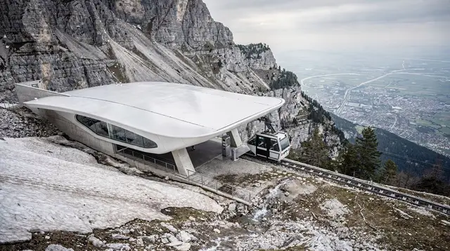
GetYourGuide does not provide a product photo for this activity — the image shows the meeting point, photographed by us.