Nordkette Sunrise: A Photographer's Planning Guide
What time do I need to leave for Nordkette sunrise photos?
Work backwards from sunrise: the three-stage ascent to Hafelekar at 2,256 m takes about 20-25 minutes once the lifts are moving, so you need to be on the first Hungerburgbahn departure of the day, not merely in town early. First-departure times shift with the season and with daylight saving changes, so check the current Nordkette timetable the evening before rather than assuming a fixed clock time.
Few European cities put you this close to a genuine high-mountain sunrise. From the middle of Innsbruck, at 574 m, the Nordkette wall rises to 2,334 m at the Hafelekarspitze in a single, near-vertical leap, and three linked cable cars can put a photographer on that ridge in roughly 20 to 25 minutes.
No shuttle bus into the hills, no pre-dawn drive on an unfamiliar road: you can be in bed in the old town and standing above the cloud line before the city below has properly woken up. That proximity is the whole reason this shoot exists, and it is also the reason people get the planning wrong — the mountain feels so close that it is easy to assume you can simply turn up and catch the light.
This guide is about the logistics of getting to that ridge for sunrise: which departure to catch, what the three-stage ascent actually involves at that hour, where to stand once you arrive, and the seasonal gaps that can quietly cancel the whole plan. It does not cover how the Nordkette cable car system works in general — timetables, tickets, and the stations themselves are in the dedicated Nordkette cable car guide — and it does not cover daytime hiking routes, which have their own guide to Nordkette hiking trails. What follows assumes you already know roughly how the lifts fit together and want to know specifically how to use them for a sunrise shoot.
Why Sunrise on the Nordkette Is Worth the Alarm
Innsbruck’s setting is dramatic at any hour, but sunrise adds two things that daytime light does not. First, the low, raking light hits the limestone faces of the Karwendel range side-on, carving out ridgelines and gullies that flatten into grey by mid-morning.
Second, in the right conditions — cold, clear, and calm — a temperature inversion settles the Inn valley under a layer of cloud or mist while the ridge above stays in full sun, so you get the classic shot of church spires and rooftops poking through a white sea, with the peaks catching the first light behind them. That inversion shot is not guaranteed on any given morning, but it is common enough in the shoulder months either side of winter that photographers plan multi-morning trips specifically to catch it.
The elevation contrast does the rest. Photographing the Golden Roof or Maria-Theresien-Straße at street level, however early, still reads as a city shot. From Seegrube or Hafelekar, the same city becomes a small cluster of rooftops at the bottom of a valley, with the Patscherkofel and the wider Tyrolean Alps stacked behind it. It is a genuinely different photograph, and one that very few Alpine cities let you reach before breakfast.
Checking the First Lift, Not Assuming It
The single most important planning step is also the one people skip: confirming the first departure time of the day, on the actual date of your visit, rather than working from a rule of thumb. The Hungerburgbahn’s first run varies through the year — earlier starts in the long-daylight months, later ones in winter — and the connecting Seegrubenbahn and Hafelekarbahn have their own first departures, which do not always line up neatly one after another.
On top of the seasonal pattern, maintenance days, weather closures (high wind, ice, or heavy snow loading can all suspend the upper sections) and one-off schedule changes are all possible. None of this is unusual for an Alpine lift system; it just means a sunrise shoot cannot be planned purely from memory or from what worked on a previous trip.
The practical routine is simple: the evening before, check the current Nordkette operating times and confirm all three sections are running as far as Hafelekar (or, if you are content with Seegrube, that the middle section is running). If sunrise falls earlier than the first lift can get you up there — which happens around the summer solstice in some years — plan for a slightly later “early light” shoot instead of a true sunrise, and treat that as a success rather than a failure of planning.
Sunrise shoot, stage by stage
| Stage | Approx. altitude | What to expect at first light |
|---|---|---|
| Innsbruck city centre | 574 m | Dark, quiet streets; walk or an early taxi to the Hungerburgbahn valley station |
| Hungerburg | ~860 m | First stop; connects to the Seegrubenbahn, a short walk or a few minutes’ wait between lifts |
| Seegrube | ~1,905 m | Open terraces right by the station, minimal walking required, good default stop |
| Hafelekar | ~2,256 m | Short uneven walk from the station to open ground; widest, highest view; colder and windier |
The Three-Stage Ascent, Timed for a Shoot
Even once the lifts are confirmed running, build in more time than the bare journey needs. The 20 to 25 minute figure for Hungerburgbahn, Seegrubenbahn and Hafelekarbahn combined assumes each connection is smooth — cars waiting, no queue, no fumbling with tickets in the dark. On the first departure of the day that is usually the case, since sunrise photographers and the odd early hiker are close to the only people travelling. But add a buffer anyway: arrive at the Hungerburgbahn valley station with 10 to 15 minutes to spare rather than sprinting for the doors, because a missed first car can mean a genuinely long wait for the next one at that hour.
Dress for the ascent itself, not just the summit. The Hungerburgbahn’s Zaha Hadid-designed stations are unheated glass-and-concrete structures, and standing around on a cold platform before dawn is its own small ordeal. A layer you can shed once you are moving, and gloves you can pull off to operate a camera, save a lot of discomfort on the way up.
Where to Shoot: Seegrube or Hafelekar
The decision between stopping at Seegrube or continuing to Hafelekar is the main creative choice on this shoot, and it is worth making before you leave rather than deciding on the platform in the dark.
Seegrube, at roughly 1,905 m, is the easier option. The terraces around the station are level, well-defined even by torchlight, and give an unobstructed view over the Inn valley and the Patscherkofel opposite. If you are shooting with a family member who is not a dedicated photographer, or you simply want to minimise the risk of stumbling on loose ground before sunrise, Seegrube is the sensible default, and it is covered in more depth, including trail options onward, in the Hafelekar and Seegrube hiking guide.
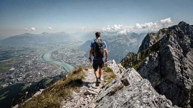
Hafelekar, at about 2,256 m, sits directly below the Hafelekarspitze summit at 2,334 m and gives a noticeably wider, higher panorama — more of the Karwendel range unfolds, and the sense of standing above the city is stronger. The trade-off is a short but genuinely rough walk from the station across loose rock and, outside summer, likely ice, done in the dark with a headlamp. It is manageable for anyone reasonably steady on their feet, but it is not the place to be improvising with slippery-soled shoes.
Neither location requires a permit or a fee beyond the lift ticket, and tripods are unrestricted outdoors at both. If the goal is the classic valley-fog inversion shot, either stop works, since the effect is driven by the weather layer below rather than by the extra 350 m between the two stations; if the goal is the widest possible mountain panorama, Hafelekar is worth the harder walk.
For a guided alternative that removes the guesswork about angles and framing, a local photography-focused outing such as a guided walk to the city’s most photogenic viewpoints can be paired with, or substituted for, a solo sunrise trip, particularly on a first visit.
Gear, Light and the Cold at 2,256 Metres
Pack lighter than instinct suggests, because everything gets carried up a cold platform and possibly across uneven ground. A single camera body, one wide-to-normal zoom for the panorama and a second longer lens for compressing the peaks are usually enough; a full bag of glass mostly stays unused while battery life quietly drains in the cold. Cold-weather battery drain is real at this altitude even outside deep winter — carry a spare, and keep it in an inside pocket rather than the camera bag.
A tripod earns its weight here: the pre-dawn light is dim enough that slow shutter speeds are routine, and a stable platform on a windy ridge matters more than it does at street level in Innsbruck. A remote release or the camera’s timer avoids shake from pressing the shutter by hand in gloves. Lens cloths matter too — condensation forms fast when a cold camera meets the relatively warmer, moister air near the station, and again on the way back down when the reverse happens.
Light itself moves quickly at this elevation. The interval from the first hint of colour in the sky to full daylight is short, and the most interesting light — the deep blue immediately before sunrise, then the brief gold minutes as the sun clears the horizon — is over within perhaps 20 to 30 minutes. Decide your composition and settle into position before that window opens rather than during it; changing spots mid-sequence usually means missing the best of it.
Wind chill deserves its own mention. Exposed ridges like Hafelekar can feel noticeably colder than any city forecast for Innsbruck suggests, even on an otherwise calm day, and standing still for photography for 30 to 45 minutes is a different proposition from walking briskly. A proper insulated jacket, a hat, and gloves that still allow some finger dexterity are not optional extras at this altitude before sunrise, in any season.
Getting Down, or Staying for the Morning
Once the light has developed past its best, the practical choices are to ride back down on the cable cars once regular service ramps up, or to walk down on one of the marked trails from Seegrube or Hafelekar toward Hungerburg. Walking extends the morning considerably and gives a completely different set of photographs — looking up at the wall you just descended, rather than out from it — but it is a separate undertaking with its own timing and fitness considerations, covered in the Nordkette hiking trails guide rather than here.
Either way, breakfast in Innsbruck afterward is one of the better rewards this itinerary offers: by the time a typical café opens in the old town, a sunrise photographer has already had several hours on the mountain and can watch the rest of the city start its day at a leisurely table.
If mornings are not your preferred working hours, some of the same terrain and angles are accessible on a guided private mountain hike timed to daylight hours instead, or via an easy guided walk around the Nordkette that trades the pre-dawn logistics for a later, gentler start.
When the Plan Falls Through: Seasonal Honesty
It is worth stating plainly what can go wrong, because a promise of guaranteed sunrise access would not survive contact with this mountain’s calendar. Tyrol’s shoulder seasons, roughly mid-April to the end of May and through November, are when the Nordkette lifts, like much of the region’s cable car infrastructure, go through annual maintenance in stages.
Any one section — sometimes more than one — can be closed on a given date during those windows, independent of the weather. A sunrise trip planned for a date in late April or mid-November needs its own same-week check of operating status; it is not safe to assume the system runs exactly as it did the previous summer or the previous winter.
Weather can also intervene outside those windows. High wind is the most common reason for a temporary suspension of the upper sections, since exposed cable car lines are sensitive to gusts in a way that valley infrastructure is not. Fresh heavy snow can cause a delayed opening while pistes and platforms are cleared. None of this is frequent enough to avoid the trip altogether, but it is frequent enough that a single-morning visit to Innsbruck built entirely around one sunrise attempt carries real risk of disappointment. Where the schedule allows, building in a second attempt the following morning is the most reliable insurance against a closed lift or a cloudy horizon.
Alternative Ways to Capture Innsbruck’s Best Angles
Sunrise on the Nordkette is the single strongest photography experience this destination offers, but it is not the only one, and it is worth having a backup plan for a trip where the timetable or the weather does not cooperate. A guided city walk built specifically around photogenic viewpoints, such as the local-led photo walk through Innsbruck’s most photogenic corners mentioned above, captures much of the Golden Roof and old-town character without depending on a lift schedule at all.
For a broader orientation before deciding where to point a camera, a general welcome tour of the city on arrival can also help scout locations for a later, better-planned sunrise attempt. And for daytime alpine views that trade the pre-dawn cold for daylight comfort, the Telfer Wiesen panoramic hike area below the Nordkette offers gentler terrain with strong views back over the city, paired with the affiliate option for a guided panoramic hike across the Telfer Wiesen.
The broader point stands regardless of which option suits a given trip: this is one of very few places in Europe where a high-mountain sunrise is a realistic before-breakfast activity from a hotel in the city centre, and that is worth planning for properly rather than treating as a spontaneous whim on the last free morning of a trip.
Nordkette Sunrise Shoots: Your Questions Answered
What time do I need to leave for Nordkette sunrise photos?
Work backwards from sunrise: the three-stage ascent to Hafelekar at 2,256 m takes about 20-25 minutes once the lifts are moving, so you need to be on the first Hungerburgbahn departure of the day, not merely in town early. First-departure times shift with the season and with daylight saving changes, so check the current Nordkette timetable the evening before rather than assuming a fixed clock time.
Does the first lift run early enough for sunrise every day of the year?
Not always. In midsummer, sunrise can fall before the first scheduled departure, in which case the closest you get is early morning light rather than the moment the sun breaks the horizon. In the depths of winter, the first lift usually beats sunrise comfortably. There is no single answer that holds across the year, which is exactly why the timetable has to be checked per trip.
Which stage should I get off at for the best sunrise shot: Seegrube or Hafelekar?
Seegrube, at about 1,905 m, gives an open, slightly lower vantage with easy footing right by the station, which suits photographers who want minimal walking in the dark. Hafelekar, at about 2,256 m below the Hafelekarspitze summit at 2,334 m, gives more elevation and a wider sweep of the Karwendel range, but involves a short walk on uneven, sometimes icy ground from the station.
Is Nordkette sunrise photography accessible in the shoulder season?
Not reliably. The intersaison windows, roughly mid-April to the end of May and through November, are when cable cars and mountain infrastructure close in stages for annual maintenance. Any of the three lifts, and sometimes more than one at once, can be off-line during these weeks, so a sunrise plan built in April or November needs to be confirmed against that day’s operating status, not assumed from a summer or winter itinerary.
How cold does it get at Hafelekar at sunrise?
Meaningfully colder than Innsbruck at 574 m, at any time of year. The temperature drop with roughly 1,700 m of elevation gain, combined with pre-dawn cold and wind on an exposed ridge, routinely means single digits or below even when the old town is mild. Photographers regularly underestimate this because the city forecast looks unremarkable.
Can I hike down after shooting sunrise instead of taking the cable car?
Yes, marked trails run from both Seegrube and Hafelekar back toward Hungerburg, and walking down after the light has developed is a common way to extend the morning. This guide covers the sunrise logistics only; trail choice, difficulty and timing for a full descent are covered in the dedicated Nordkette hiking guide.
Do I need a tripod permit or is photography restricted at Nordkette?
No permit is required for personal, non-commercial photography at the viewing areas, platforms and marked trails. Tripods are fine outdoors; inside the cable car stations, keep gear compact and be mindful of other passengers, especially on a small early car.
Is a guided tour worth it for sunrise photography compared to going alone?
A private guide adds value mainly through local knowledge of angles, timing and current conditions, and through company on a cold, dark, solo departure. Going alone costs less and gives full control over pace and framing, but means doing the timetable-checking and route-finding yourself. Both are reasonable; the right choice depends on how much you value that local read of the mountain on the specific morning you go.
Photo tours on GetYourGuide
Verified deep-linked GetYourGuide tours. Book through these links and we earn a small commission at no cost to you.
GetYourGuide does not provide a product photo for this activity — the image shows the meeting point, photographed by us.