Patscherkofel Cable Car: Innsbruck's Gentler Mountain
What is the Patscherkofel cable car and how is it different from the Nordkette?
The Patscherkofelbahn is a gondola rising from Innsbruck's southern edge to about 2,246 m, reaching rounded, forested, walkable terrain rather than the Nordkette's sheer rock face to the north. It suits families, easy hikers and anyone who wants alpine views without exposed ground underfoot.
Innsbruck has two mountains hanging directly over it, and they could hardly be more different. The Nordkette rears up on the north side of the valley in a wall of grey rock, its cable car climbing in three fast stages to jagged, exposed terrain. The Patscherkofel does the opposite job on the south side: a single long gondola ride to a rounded, mostly forested summit at about 2,246 m, where the paths are gentle and the mood is calmer. If the Nordkette is the mountain you photograph, the Patscherkofel is often the one you actually walk on without a second thought about footing.
This guide covers the Patscherkofel cable car itself — where it starts, what it costs, what is at the top, and who it suits — not the village of Igls at its base, which has its own guide, and not the Nordkette, which is covered separately too.
Where the Patscherkofel sits, and why it feels different
The Patscherkofel rises on the southern flank of the Inn valley, above the district of Innsbruck closest to Igls and the wider Wipptal. Its summit is lower than the Nordkette’s high point at Hafelekarspitze (2,334 m), but the difference in height is less important than the difference in shape. The Nordkette’s upper slopes are broken rock and scree above the Seegrube and Hafelekar stations, terrain that suits climbers and confident hikers more than casual visitors. The Patscherkofel’s upper slopes are smoother, with meadow and low scrub instead of bare rock, and a tree line that climbs higher up the mountain before giving way to open ground.
That gentler geology has a direct practical effect: more of the mountain is walkable by more people. A family with children, a visitor recovering from a long flight, or anyone who simply does not want a day of scrambling can ride the Patscherkofel gondola and still have a proper mountain outing at the top, rather than a viewing platform experience only.
The cable car: route, times, prices
The Patscherkofelbahn is a single continuous gondola, not the linked three-stage system used on the Nordkette. It runs from its valley station up to an upper station at roughly 1,964 m, doing the height gain in one uninterrupted ride rather than three separate cabins and changeovers.
| Stage | Approximate altitude | Notes |
|---|---|---|
| Valley station | ~925 m | Access point from Innsbruck’s southern edge |
| Upper station | ~1,964 m | Restaurant, terrace, trailheads |
| Patscherkofel summit | ~2,246 m | 20-30 minute walk from the upper station |
Because it is one continuous ride rather than a change of cabins partway up, the trip up feels quicker and simpler than the Nordkette’s sequence of funicular and two cable car stages. A one-way ride typically takes well under 10 minutes; allow more time overall for waiting at busy periods, particularly fine-weather weekends in winter and midsummer.
Ticket prices change from season to season and are best checked directly before a visit rather than assumed from an old figure. What stays constant is the structure: a return ticket for the gondola alone, and in winter a day pass valid across the wider ski area that includes the Patscherkofel. For a single up-and-down visit outside ski season, a straightforward return fare is usually the simplest option, and it is often bundled with a guided activity — see the tours below for ready-made options that include the lift.
What to do once you are up there
The upper station at around 1,964 m has a restaurant and a terrace that is one of the better places around Innsbruck for a relaxed lunch with a view, since it faces back down the valley rather than into a wall of rock. From here, most visitors do one of three things.
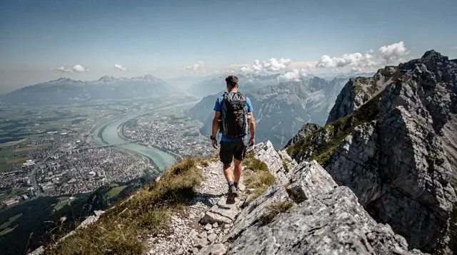
Walk to the summit. The path from the upper station to the actual Patscherkofel summit at about 2,246 m takes roughly 20 to 30 minutes at an easy pace, on ground that is graded and clear rather than a scramble. It is a realistic option for most visitors in reasonable shape, which is one of the clearest practical differences from the Nordkette, where reaching comparable altitude usually means committing to a marked mountain trail rather than a short stroll.
Stay near the station. Shorter loop paths close to the upper station suit anyone who wants alpine air and a view without a summit push — families with small children, or visitors short on time between other plans in the city below.
Head out on a longer route. Beyond the summit, trails continue toward other points on the ridge and down into the surrounding Wipptal side valleys, for hikers who want a full day rather than a short outing. Full route detail belongs in the dedicated Patscherkofel hiking guide, since trail conditions and waymarking change with the season.
For a structured version of any of this, a circular hike on the Patscherkofel with a local guide covers the ride up, the walking route, and the context that is easy to miss when exploring alone. Early risers can instead book a sunrise tour on the Patscherkofel, which times the first lift of the day to catch the light coming up over the Kitzbühel Alps to the east while the city below is still quiet.
The view: looking north instead of south
The single best reason to come up the Patscherkofel, rather than only the Nordkette, is the direction it faces. From the Nordkette’s stations, the view looks south and east over Innsbruck toward the Patscherkofel and the Tux Alps beyond. From the Patscherkofel, the view runs the other way: across the whole city, the Inn valley floor, and straight up at the Nordkette’s rock wall rising on the far side. Seeing the Nordkette from a distance, as a complete mountain rather than a set of cable car stations, is something the Nordkette’s own viewpoints cannot give you, since you cannot see the mountain you are standing on.
On a clear day the outlook extends well beyond the two immediate mountains: south-west toward the peaks around the Stubai valley, and east toward the softer ridgelines that lead eventually to the Kitzbühel Alps. It is a wide, orienting panorama rather than the more vertiginous, close-in views typical of the Nordkette’s higher stations.
Patscherkofel vs Nordkette vs Axamer Lizum and Muttereralm
Visitors planning an Innsbruck mountain day sometimes mix up the Patscherkofel with other areas that share the same ski pass but are entirely different mountains, reached from different sides of the city.
| Mountain | Direction from city | Character | Best for |
|---|---|---|---|
| Nordkette | North | Steep, rocky, exposed | Dramatic views, experienced hikers, freeride skiing |
| Patscherkofel | South | Rounded, forested lower down, gentle upper trails | Families, easy hikers, relaxed views |
| Axamer Lizum | South-west, separate valley | Open ski bowl, Olympic downhill heritage | Skiing, not a casual sightseeing trip from the centre |
| Muttereralm | South-west, above Mutters | Local ski hill, mountain biking in summer | Bikepark Innsbruck, quieter skiing |
All four are part of the Olympia SkiWorld Innsbruck pass area in winter, along with several other zones, and free ski buses connect them to the city. But only the Nordkette and the Patscherkofel sit close enough to central Innsbruck to visit as a half-day trip without a ski pass or a car; Axamer Lizum and the Muttereralm are proper day excursions to a different valley, best planned as their own outing rather than tacked onto a city stroll.
Getting to the valley station
The Patscherkofelbahn’s valley station is on the southern edge of Innsbruck, a short bus or tram ride from the old town — check current IVB routes and times before travelling, since city transport schedules are revised periodically. It is a different starting point from the Hungerburgbahn, which serves the Nordkette from the city’s northern side, so allow time to cross the valley if combining both mountains in one visit rather than assuming they share an access point.
Drivers will find parking near the valley station, though as with most of Innsbruck’s popular sites, arriving by public transport avoids the search for a space on busy days.
Winter on the Patscherkofel
In the ski season, the Patscherkofel functions as one of the closest-to-town areas within the Olympia SkiWorld Innsbruck pass, with pistes suited to intermediate skiers more than experts — a further expression of the mountain’s overall gentler character. It is a sensible choice for a first or second day of a ski week based in the city, saved as one stop among several rather than the only mountain skied, in keeping with the local pattern of skiing a different area on the pass each day rather than committing to one resort. Full piste detail belongs with the ski pass guide rather than here.
Combining the Patscherkofel with the rest of a visit
Because the Patscherkofel is reachable from the city centre in well under half an hour door to door, it slots easily into a day that also includes time in Innsbruck itself. A common pattern is a morning in the old town around the Golden Roof, followed by an afternoon gondola ride and a short summit walk before the light starts to fade. Anyone weighing the Patscherkofel against the Nordkette for a single mountain visit, rather than doing both, should read the dedicated comparison at Nordkette or Patscherkofel: which mountain, which sets out the trade-offs between drama and ease in more detail than fits here.
Visitors staying in Igls itself, rather than central Innsbruck, are effectively already at the mountain’s doorstep; the practicalities of basing a stay there instead of in the city are covered in staying in Igls vs Innsbruck city.
For a broader look at how the Patscherkofel and the Nordkette fit into Innsbruck’s Olympic story — both mountains hosted events across the city’s 1964 and 1976 Winter Games — the Innsbruck Olympic heritage walk connects the two through their shared history rather than only their present-day cable cars.
Those who prefer a guide rather than working out routes alone can book a private guided mountain hike that can be tailored to the Patscherkofel’s easier terrain, a useful option for mixed-ability groups or a first alpine outing. And for a straightforward ride up without a hiking component, a plain Top of Innsbruck roundtrip cable car ticket covers transport on several of the city’s cable cars for visitors planning to compare more than one mountain on the same trip.
Patscherkofel cable car: frequently asked questions
How high does the Patscherkofel cable car go?
The gondola’s upper station sits at roughly 1,964 m, just below the Patscherkofel summit at about 2,246 m, which is reached by a short additional walk of around 20-30 minutes on an easy path.
Is the Patscherkofel the same as Igls?
No. Igls is the village at the foot of the mountain, covered on its own page. This guide covers the cable car and the mountain terrain above it, not the village itself.
Is the Patscherkofel part of the Olympia SkiWorld Innsbruck pass?
Yes, the Patscherkofel is one of the areas bundled into the Olympia SkiWorld Innsbruck ski pass in winter, alongside separate areas such as Axamer Lizum and the Muttereralm, which are different mountains with their own lift systems.
Is the Patscherkofel easier than the Nordkette?
Generally yes. The Patscherkofel’s upper slopes are rounded and largely tree-lined lower down, with gentler gradients and less exposure than the Nordkette’s steep rock face and via-ferrata-grade terrain above Seegrube.
Can you see the Nordkette from the Patscherkofel?
Yes, one of the main reasons to go up is the reverse view: the Patscherkofel looks north across the Inn valley and the whole city of Innsbruck to the Nordkette wall, a perspective you cannot get from the Nordkette itself.
Do I need hiking experience to enjoy the Patscherkofel?
No. There are short, well-marked paths near the upper station suitable for casual walkers, as well as longer routes for those who want a proper hike, so the mountain works for a wide range of fitness levels.
Is the Patscherkofel open in summer?
Yes, the cable car typically runs through the hiking season from late spring to autumn, in addition to the winter ski season, though exact operating dates change year to year and should be checked before travelling.
Cable cars and viewpoints on GetYourGuide
Verified deep-linked GetYourGuide tours. Book through these links and we earn a small commission at no cost to you.
GetYourGuide does not provide a product photo for this activity — the image shows the meeting point, photographed by us.